Scafell Pike via the Corridor Route, Route Map

Route Map
Guide
Digital Route Map
Digital Guide

Scafell Pike via the Corridor Route, Route Map

£4.99

The most popular route up England’s highest mountain. A clear, printable route map for Scafell Pike via the Corridor Route from Wasdale Head, with an elevation profile and step-by-step overview. High-resolution PNG file included.
SKU MAP-SCAFELL-CORRIDOR Categories , Tags , , , , ,
Route
Guide

About This Route

About This Guide

Scafell Pike is the highest mountain in England. This route climbs from Wasdale Head up the Corridor, over Lingmell Col, and on to the summit, returning the same way. Distance: 9.5 km / 5.9 miles. Ascent: 978 m / 3,209 ft. Time: 5 to 7 hours. Difficulty: Strenuous. Start and finish: Wasdale Head car park (78 m). What you get: A detailed topographic route map with the path clearly marked, contour lines, viewpoints, parking, and a numbered route overview. An elevation profile shows the climb ahead so you know exactly what to expect. Print it for the day or carry it on your phone. In the download: One high-resolution PNG file. Print it for the day or keep it on your phone. Plan, prepare, explore.
Route
Guide

In The Download

In The Guide

Try Before You Buy

Free 1-page sample

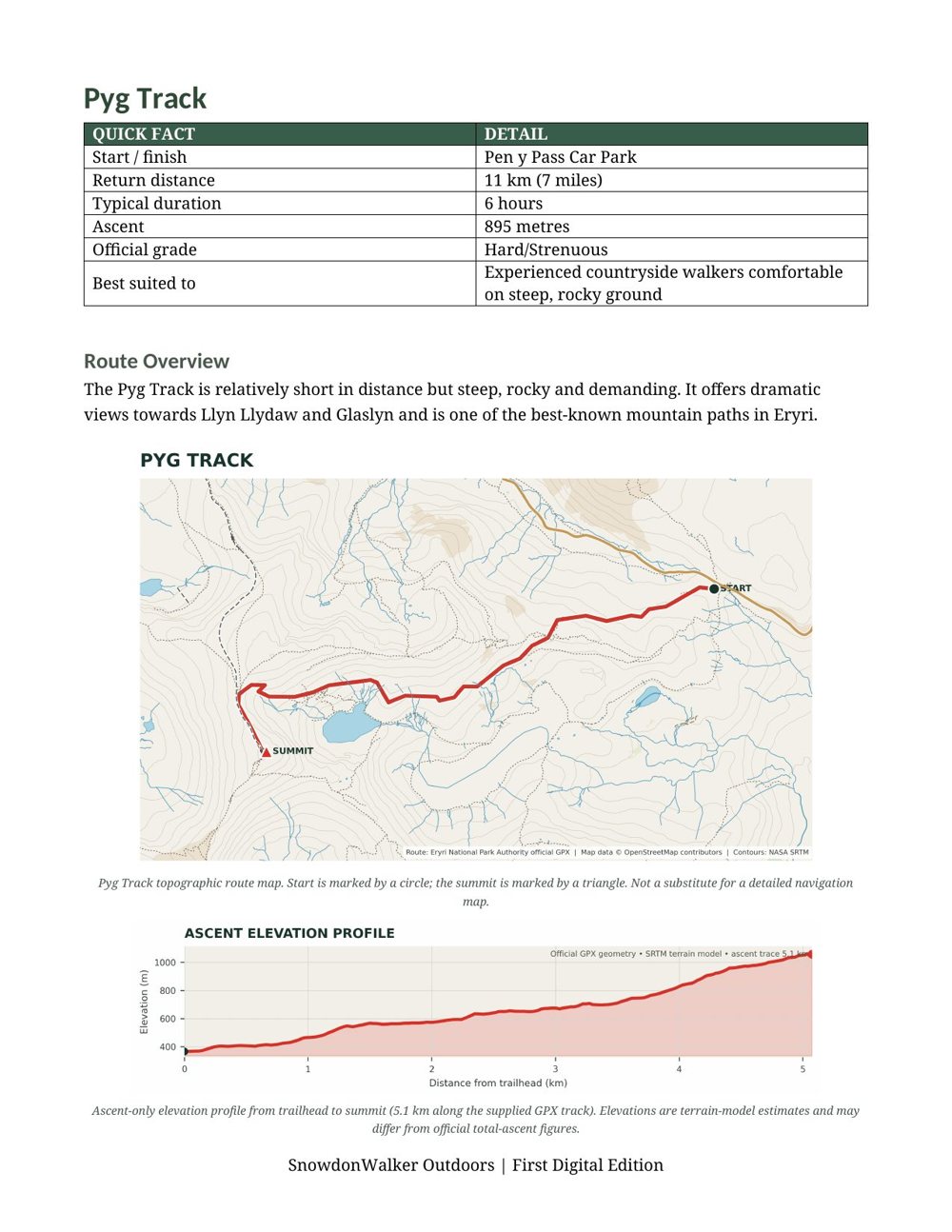
Take a look inside before you buy. This is the Pyg Track page from the guide: quick facts, a topographic route map and an ascent elevation profile. Every path in the guide has a page like this.

PLAN YOUR NEXT CLIMB

More route maps for Britain’s best-known peaks. Every path marked and measured, ready to print or carry on your phone.