A 30-page PDF guide to all six principal paths up Yr Wyddfa (Snowdon), with route maps, elevation profiles, kit, weather, navigation and safety advice. Instant download.
Walking Yr Wyddfa is more than reaching a summit. This complete digital guide helps you choose the right path, understand the mountain and return home with memories worth keeping.
What is inside
All six principal summit paths: Llanberis Path, Pyg Track, Miners’ Track, Rhyd Ddu Path, Snowdon Ranger Path and Watkin Path.
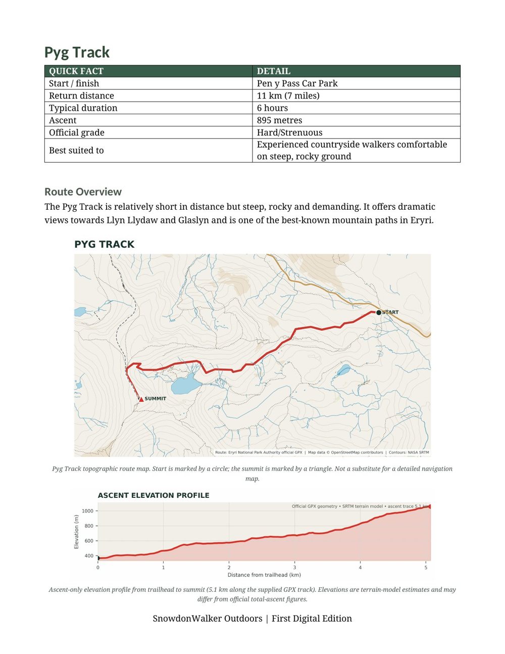
For every path: quick facts (start point, return distance, typical time, ascent and official grade), a topographic route map and an ascent elevation profile.
A route comparison table and a “Which route is right for you?” section.
Planning your walk, choosing a route, essential equipment, weather and mountain safety, and navigation.
Leave No Trace and responsible walking, and what to do in an emergency, including a feature on Llanberis Mountain Rescue Team.
A mountain walking glossary, a before-you-go checklist, and a list of official sources for checking current information.
Good to know
Format: PDF, 30 pages. First digital edition, written by Mark J Smith.
Route statistics were checked against Eryri National Park Authority information in August 2026.
All six paths are officially graded Hard/Strenuous. The guide is written primarily for non-winter conditions.
The maps and profiles are schematic planning aids, not navigation maps. Carry a suitable detailed map and compass.
Instant download after purchase. No account needed.
Route
Guide
In The Download
In The Guide
One high-resolution PNG route map
Path marked with numbered overview
Elevation profile and key stats
Print at home or carry on your phone
Instant download after purchase
30-page PDF guide
All six principal paths up Yr Wyddfa
A route map and elevation profile for each path
Kit, weather, navigation and safety advice
Instant download after purchase
Try Before You Buy
Free 1-page sample
Take a look inside before you buy. This is the Pyg Track page from the guide: quick facts, a topographic route map and an ascent elevation profile. Every path in the guide has a page like this.